Live Satellite View, 3D Map
- 3.9
- Rating
- 100.00K
- Installs
- Free
- Price
 Analysis by App-foxy
I approached Live Satellite View, 3D Map as a visual navigation app rather than a complete replacement for a traditional route planner. Its main appeal is the chance to inspect places through satellite-style imagery and a three-dimensional map view, which can make an unfamiliar area easier to understand before I visit it. That difference matters: I found it more useful for looking around, checking the shape of a neighborhood, and building a sense of place than for handling every part of a daily commute.
The app comes from Banix Studio and sits in the Maps & Navigation category. It is free to start, rated for Everyone, and supports devices running Android 7.0 or later. The current release is version 3.0, and the app has passed the 100K+ install mark with an average rating of 4.4 from around 324 ratings. Those figures suggest a reasonably established audience, although the relatively small review pool means I would still treat the rating as a useful signal rather than absolute proof that it will behave identically on every phone.
How the app feels when exploring places
I find the app most helpful when I treat map browsing as a way to prepare, not as a substitute for getting around. In this section, I focus on how the satellite-style and 3D perspectives can help me build a mental picture of an unfamiliar place—and on choosing the right view before I decide what to inspect next.
You May Also Like

 Blood Strike: 2.5 Anniversary
Blood Strike’s Loadouts Turn Every Drop Into a Tactical Gamble
A close look at Blood Strike’s custom loadouts: how fast access to signature weapons reshapes its battle royale rhythm, rewards preparation, and narrows the gap between fights.

 Pandora - Music & Podcasts
Pandora’s Music Is Easy to Start, but Harder to Recover
Pandora’s strength is its low-effort path from a seed to a station. Its weak spot is how much confidence it asks you to place in connection, setup, and quiet recovery.

 8 Ball Pool
 Is Built on Rivalries, Rematches, and Routine
A close look at the rivalries, rematches, shared routines, and unanswered safety questions that turn a quick pool match into a persistent mobile community.

 Samsung Music
’s Quiet Strength Is Playing What You Already Own
Its reach comes less from spectacle than from dependable access to a personal library. That simplicity is both the app’s strongest retention engine and its ceiling.

 AccuWeather: Weather Radar
AccuWeather Review: A Quick, Clear Forecast for Everyday Decisions
For everyday plans, the best forecast is the one you can understand quickly. AccuWeather makes rain timing, radar, and local conditions easy to act on, with a few trade-offs.

 Hill Climb Racing
Why Hill Climb Racing Still Turns Crashes Into One More Run
A tiny car, a bumpy hill and one more upgrade: Hill Climb Racing keeps resurfacing because its simple chaos makes every near-miss feel personal.
More From Our News Desk



Fast enough for casual map browsing
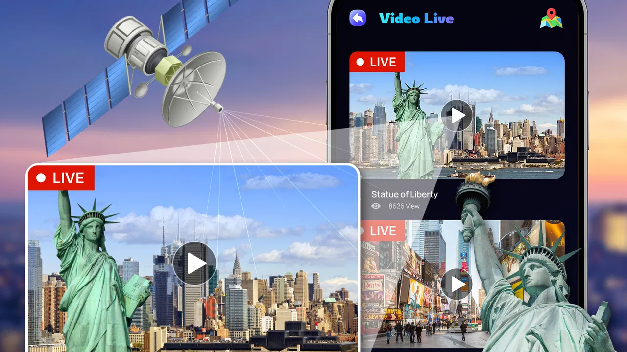
My first impression is that the experience is built around quick visual exploration. I can open a location, move around the map, and switch attention between the wider area and a closer view without feeling that I am using a complicated professional mapping tool. The short description, “Live Satellite View,” sets the right expectation for the central experience: this is about seeing places from above and understanding them visually.
That makes the app particularly handy when I want context rather than a list of directions. For example, before meeting someone at an unfamiliar venue, I can inspect the surrounding streets, identify nearby open spaces, and get a better idea of how the building sits within the neighborhood. A standard map often tells me the names of roads, but the satellite and 3D presentation can answer a different question: what does this area actually look like from above?
The perceived speed depends heavily on how much I ask the screen to display at once. A broad overview is naturally easier to handle than repeatedly zooming into detailed areas, rotating a three-dimensional scene, and moving across several locations in quick succession. I would not judge the app by the instant response of a simple text-based map. Its visual presentation has more work to do, so a slight pause during demanding exploration is less surprising than it would be in a basic route list.
One useful habit is to begin with a wide view and narrow the search gradually. Instead of jumping immediately to the closest possible level, I first locate the district, then the street, and only then inspect the specific surroundings. This is not just easier on the device; it also helps me keep my bearings. A highly magnified view can look impressive while making it harder to understand where the location sits in relation to the rest of the area.
Where the three-dimensional view earns its place
The 3D perspective is most valuable when flat map symbols leave too much to interpretation. I find it useful for getting a rough sense of terrain, building arrangement, and the direction in which streets run. It can also help when I am planning a walk through a place I have never visited, because visual landmarks are often easier to remember than a sequence of road names.
There is a trade-off, though. A three-dimensional view is not automatically more informative at every zoom level. When the scene becomes crowded, perspective can make nearby objects overlap and reduce clarity. I prefer to use the 3D presentation as a confirmation tool: first understand the general layout, then tilt or rotate the view to answer one specific question. Trying to study an entire busy district in a tilted view can be less clear than returning briefly to a simpler overhead angle.
This workflow is one of the app’s less obvious strengths. I do not treat the satellite image and 3D view as competing modes. I use the overhead view to orient myself, the satellite-style imagery to inspect the real shape of the area, and the three-dimensional perspective to check visual relationships. That combination makes the app more practical than simply opening it and dragging around without a purpose.
A realistic everyday scenario
Imagine that I am visiting a new neighborhood for an appointment. I know the general address, but I am unsure whether the entrance faces the main road or a smaller side street. Before leaving, I use the app to inspect the block, look at the surrounding layout, and note nearby visual landmarks. When I arrive, I am not relying only on a pin; I already have a mental picture of the area.
That use case shows both the app’s value and its boundary. It can improve preparation, but I would not rely on a visual map alone for time-critical navigation. Traffic conditions, temporary road changes, restricted access, and the exact entrance to a building may require a conventional navigation service or information from the venue itself. Live Satellite View, 3D Map works best as a visual companion, not as the only source of travel decisions.
What happens during heavier exploration
The most demanding moments come when I move quickly between distant places, zoom repeatedly, or spend a long session rotating and tilting the three-dimensional view. Those actions are more resource-intensive than checking one location and closing the app. On a modern phone, I would expect the experience to feel more comfortable when the device has enough free memory and the map is allowed to load without several other demanding apps competing in the background.
I also recommend avoiding a chaotic search pattern. If I jump from one continent to another, zoom in and out constantly, and change perspective after every gesture, I create a less predictable experience for myself even before considering the phone. A more deliberate sequence—search, wait for the view to settle, inspect, then move on—makes the app easier to use and helps distinguish an actual problem from a moment of heavy visual loading.
For long browsing sessions, screen brightness and mobile data use are practical considerations. Satellite imagery is visually richer than a plain map, so I would use it thoughtfully when away from Wi-Fi, especially if I am exploring many locations rather than checking one. The app is free to download and use, but it includes in-app purchases ranging from $1.99 to $9.99 per item. I would therefore pay attention to any purchase prompt and decide whether the free experience already covers my needs before spending money on extras.
The purchase range is not a reason to dismiss the app, but it does change how I evaluate it. A casual user who only wants occasional visual exploration should first see whether the basic tools are sufficient. Someone who expects to use the app frequently should consider the value of any optional purchase in relation to the specific function it unlocks, rather than assuming that paying automatically improves map accuracy or navigation reliability.
Stability and recovering from interruptions
Map applications are often used in imperfect conditions: I may switch to another app, lose a connection, lock the screen, or return after the phone has paused background activity. In that situation, I value simple recovery more than flashy presentation. My preferred approach with this app is to reopen the last area calmly, allow the imagery to settle, and avoid immediately repeating several gestures if the view appears incomplete.
If the app comes back to a less useful position after an interruption, having the place name or address ready makes recovery much easier. I would also keep a note of the key location when preparing for an important visit instead of assuming that the app alone will preserve every step of my exploration. This is a small but important distinction between browsing for interest and preparing for a real journey.
For dependable arrival, I would pair the app with a conventional navigation tool. Standard navigation apps usually have the advantage when I need turn-by-turn guidance, route alternatives, transit details, or traffic-aware decisions. Live Satellite View, 3D Map has a different role: it helps me understand the physical setting behind the route. Using both can be more effective than forcing one app to do everything.
Device fit and practical limits
Because the app supports Android 7.0 and later, it is available to people using a broad range of Android phones. Compatibility alone does not guarantee the same experience on every device, however. A newer phone with a stronger processor and more available memory is likely to feel more comfortable during extended 3D exploration than an older entry-level handset. I would be especially cautious about expecting smooth movement while many other apps are active.
Storage and battery habits also matter in practical use. Visual map browsing can encourage longer sessions because it is easy to keep exploring one area after another. If I am heading out with a low battery, I would inspect the location before leaving rather than spending the whole trip rotating the map. I would also avoid treating the app as a substitute for offline preparation when I know connectivity may be uncertain.
The Everyone content rating makes the app approachable for a wide audience, including families who want a simple way to look at places together. Still, younger users may need guidance about interpreting satellite imagery. A picture from above does not automatically show whether a road is open, whether an entrance is public, or whether a location is safe to access. The app can support curiosity and planning, but common sense remains essential.
Who will enjoy it most
I think this app suits travelers, students, curious map readers, property viewers, and anyone who likes understanding places visually. It is also useful for planning a photo walk, checking the relationship between a landmark and nearby streets, or giving a child a more engaging introduction to geography. The visual approach makes abstract map information feel more concrete.
It is less suitable for someone whose first requirement is precise, continuous route guidance. If I need voice instructions, live traffic decisions, public transport planning, or a carefully optimized trip, I would choose a dedicated navigation service first. This app may complement that service, but it should not be selected solely because the word “live” sounds like a promise of constantly updated travel conditions. I read the name as an invitation to explore a live-feeling map view, not as a guarantee that every road condition changes instantly.
I would also skip it if I only want a very lightweight map for checking a street name. In that case, a simpler map can be quicker and less demanding. The strengths here appear when the visual layer adds genuine understanding. If I am not going to use satellite imagery or the 3D perspective, I may be carrying extra complexity without receiving much benefit.
Small techniques that improve the experience
My first tip is to use the app before the journey, not while rushing to make a turn. I can inspect a destination in a calm setting, identify the surrounding layout, and then use a dedicated navigation option when it is time to travel. This division of labor reduces the temptation to make urgent decisions from a visually attractive but incomplete map view.
My second tip is to compare perspectives instead of staying in one mode. If a location looks confusing from above, I switch to the three-dimensional presentation for a different sense of orientation. If the 3D scene becomes cluttered, I return to the overhead view. The best result comes from using each perspective for the question it answers most clearly.
My third tip is to search with a specific purpose. I might ask whether a building sits near a main road, whether a park is surrounded by streets, or how a neighborhood connects to a larger area. Specific questions make the app more efficient and prevent endless zooming that drains time and battery without improving my understanding.
A fourth useful habit is to keep a backup plan for important destinations. I save the address in whatever navigation method I normally trust and treat the satellite view as visual preparation. That way, if the map takes time to reload or the view is not clear enough at the exact moment I need it, I still have a practical route option available.
My performance verdict
After using it as a visual exploration tool, I see Banix Studio’s app as a focused and approachable addition to the Maps & Navigation category. Its strongest quality is not that it replaces every mapping service; it is that satellite imagery and 3D presentation can answer questions that a basic route screen leaves unanswered. I can understand the shape of a place, prepare for an unfamiliar destination, and explore areas in a more visual way.
The performance judgment needs to be equally focused. For short sessions and gradual exploration, the app should appeal to users who want a straightforward way to inspect locations. Heavy zooming, rapid movement across the map, and extended 3D browsing are the moments when device capability, available resources, and connection quality become more important. I would keep expectations realistic on older hardware and avoid judging the app as though it were a minimal text map.
With a 4.4 average and more than 100K+ installs, it has enough reach to deserve consideration, while the 48 written reviews give potential users some community feedback to examine. I would not install it expecting a full travel command center. I would install it because I want a visual window onto places and because the combination of satellite-style viewing and 3D perspective can make preparation more intuitive.
My recommendation is simple: try it if you enjoy exploring locations, planning visits visually, or checking the setting around an address. Use it alongside—not instead of—a conventional navigation app when timing and directions matter. For me, that balanced role is where Live Satellite View, 3D Map makes the most sense: a free visual map companion with a clear purpose, useful perspective changes, and enough practical value to earn a place on the phone of anyone who likes to know what a destination looks like before arriving.
FAQs for Live Satellite View, 3D Map
01What is Live Satellite View, 3D Map and how does it work?
Live Satellite View, 3D Map is an application that provides users with real-time satellite imagery and interactive 3D maps. It allows you to explore any location on the globe from a bird’s-eye view, offering detailed visuals and geographic information. The app uses satellite data to deliver up-to-date images and information.
02Do I need an internet connection to use Live Satellite View, 3D Map?
Yes, an internet connection is required to access live satellite images and 3D maps. The application relies on real-time data from satellite feeds, which are continually updated. A stable connection ensures the best performance and the most current images and map details.
03Is Live Satellite View, 3D Map available for both Android and iOS devices?
Yes, Live Satellite View, 3D Map is available for download on both Android and iOS platforms. You can find the application on the Google Play Store for Android devices and the Apple App Store for iOS devices. Ensure your device meets the compatibility requirements before downloading.
04Are there any subscription fees or in-app purchases in Live Satellite View, 3D Map?
While Live Satellite View, 3D Map is free to download, it may offer in-app purchases or subscription options for enhanced features. These might include ad-free usage, higher resolution images, or additional functionalities. Check the app’s description for detailed information on available purchases.
05How accurate and up-to-date is the information provided by Live Satellite View, 3D Map?
The app strives to offer accurate and timely information by utilizing real-time satellite data. However, the frequency of updates can vary depending on the location and available satellite coverage. Always cross-check critical information through additional reliable sources when necessary.
Pros
- Real-time satellite imagery available.
- 3D maps enhance navigation experience.
- User-friendly interface design.
- Frequent updates with new data.
- Offline mode for certain features.
Cons
- Heavy data usage
- requires Wi-Fi.
- Limited offline map availability.
- Some areas lack detailed imagery.
- Occasional app crashes reported.
- Subscription required for premium features.

Live Satellite View, 3D Map
Gallery